


CARTHEW SUMMIT
Contributed by Paul Krystof
FACTS
Country: Canada
Location: Waterton National Park
One-way trip: 20 km
Start elevation: 1660 m
Final Elevation: 2311 m
Maps: (1:50,000): 82 G/1 and 82 H/4 or Environment Canada Parks Service map for Waterton Lakes
GETTING THERE
From the Akamina Parkway trail head in Waterton National Park head east on the trail to Summit Lake.
PARTIAL PLANT LIST
Papaver pygmaeum
Polemonium viscosum
Sedum integrifolium
Sedum lanceolatum
Potentilla nivea
Senecio conterminus
Dryas octopetala
Silene acaulis
Castilleja rhexifolia
Kalmia microphylla,
Hypericum formosum,
Ledum glandulosum,
Tofieldia glutinosa,
Xerophyllum tenax
Penstemon ellipticus
Aquilegia flavescens
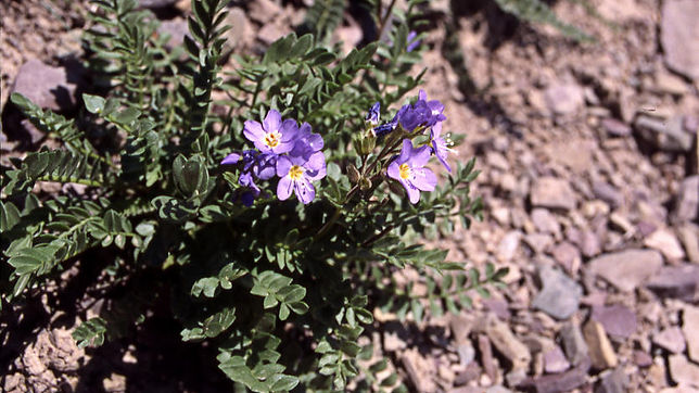
Gentiana calycosa
Epilobium latifolium
Delphinium bicolor


The Carthew-Alderson trail is a superb route to see some of the very best scenery in Waterton Lakes National Park. The hike starts at scenic Cameron Lake at the terminus of the Akamina Highway. At first the trail switch backs up through dense forest of aged spruce and fir to more open subalpine where after about 4 kilometres you arrive at picturesque Summit Lake.
The shores are rich with vegetation and some of the plants seen are: Kalmia microphylla, Hypericum formosum, Ledum glandulosum, Tofield branches ia glutinosa, Xerophyllum tenax to name a few. The view to the south, over the lake, is dominated by the Chapman Peak at 2867 metres. Here at a well marked junction, the Carthew Summit trail left and continues at a slightly steeper grade through a subalpine mix of trees and meadows with the alpine larch being more prevalent as the elevation increases. The openings are dominated by Xerophyllum tenax . The rocky outcroppings in this area support various sedum, penstemon, draba, arnica, erigeron and other sun loving plants.
Approximately 1 kilometre from the lake the subalpine forest gives way to steep meadows and even steeper scree slopes as the trail nears the switch-backs to the Carthew Summit. The red colour of the rocks here is mostly argilite of the Kintla formation, shale common in this region. Plants growing in this area are mostly various senecio, lupinus, , erigeron, phacelia with some spectacular displays of Penstemon ellipticus and a Castilleja sp. near the last island of trees as the trail begins to wind up the scree slope. Four switch-backs take the path up to the summit at the elevation of 2311 metres. Once here, a right turn takes you over a narrow ridge to a rocky outcrop with views over the Boundary Creek area and further south Chapman Peak and Mt. Custer tower over Lake Wurderman and Lake Nooney, respectively. If you are so inclined, a left turn at the summit will take you to a scramble up the lower peak of Mt. Carthew or beyond. The plant life near the summit is varied and rewarding, especially if the timing is correct. Most years it may be mid to late July.
The scenery ahead is unforgettable as the Upper and Lower Carthew Lakes are nestled in a basin flanked on the left by Mt.Carthew at 2639 metres and on the right by Mt.Alderson at 2692 metres
Here, one may want to turn around and retrace the 8 kilometres back to Cameron Lake while others may want to experience the entire loop and continue on for about 12 kilometres to the townsite. The trail drops at a varied rate of decline to the upper Carthew Lake with icy snow patches persisting in the area well into August and beyond. As the amount of ground moisture increases Aquilegia flavescens, and Gentiana calycosa make colourful trailside displays. The path follows the west side of the Carthew Lakes with some fantastic Epilobium latifolium and senecio patches along the route. As we near the lower lake the stunted krumholz conifers make an appearance and vegetation becomes taller and greener especially past the lower lake. The trail becomes noticeably steeper in this area and drops sharply in the 3 kilometres it takes to reach the Lake Alderson junction. In the sparse subalpine forest here one can find, in season, patches of Gentiana calycosa. Lake Alderson is at the foot of a 700 metre rock wall of Mt. Alderson. There is a campground here but check and book with the Parks Information office. The remaining 7 kilometres of trail follow Alderson, Carthew and Cameron Creeks, respectively, with occasional open avalanche slopes mostly in the first few kilometres. The trail comes out of the forest at Cameron Falls near the town campground.


